
Thermal Data
Beyond NDVI
Thermal | VS | NDVI | VS | Thermal | VS | NDVI
NDVI is commonly used and Hydrosat applies it, but not on its own…
NDVI = Normalised Difference Vegetation Index, a measure of vegetation cover, which is used as a proxy for general crop health. However, relying on this measurement alone can lead to many misjudgements:
NDVI does not account for the crop growth cycle.
If a plant is just growing, NDVI will be at 10 – 20%, values which would normally be cause for concern, however on the ground it is understood that the plant is fine and just doesn’t cover a large area due to its infancy.
NDVI does not account for different crop types.
Broadleaf crops, like sugar cane or corn, can easily reach over 90% but things like onions or garlic rarely reach 60%. This doesn’t mean the crop isn’t healthy it just is a result of the crop cover from its size.
NDVI isn’t measured daily.
NDVI comes from visible images, mainly Sentinel satellites, which only update every 5 days, not daily like thermal imagery. Plus, if there are clouds, this 5-day cycle could be extended. And if there are clouds, it may take longer.
The classic solution for ET is based on data from weather stations and crop coefficients...
ETa = Real/ Actual Evapotranspiration
This is the one actually produced in the existing conditions of the crop.
Kc = Crop Coefficient
FAO-56 Kc are a standardised, dimensionless factor which converts reference evapotranspiration (ET₀) into crop-specific water use (ETc) at each growth stage.
The FAO-56 tables provide three key values per crop:
- Kc initial: from planting to ~10% ground cover; low, dominated by soil evaporation
- Kc mid: full canopy, peak water demand; typically ranges from 1.0 to 1.25
- Kc end: late season through senescence; drops as leaves die off
These are general defaults for a sub-humid climate with moderate wind.
ETp = Potential Evapotranspiration
The maximum ET a given surface could achieve considering the energy and atmospheric conditions, assuming the soil is always fully wet/ water was not a limiting factor.
ETo = Reference Evapotranspiration
(Penman- Monteith recommended by the FAO)
Standard evapotranspiration parameter based on an area that assumes grass as a reference crop, well irrigated, growing and continuously covering the soil surface, with uniform height of 0.12m and a surface strength of 70 sm-1 and albedo of 0.23.
ETc = Crop Evapotranspiration
This is a theoretical ET value of the crop under standard conditions, from experimentation (healthy, well-fertilized crop and in optimal soil moisture conditions).
These calculations aren’t very accurate as you generalize too much.
So if Kc is time and place specific, it is therefore not universally applicable
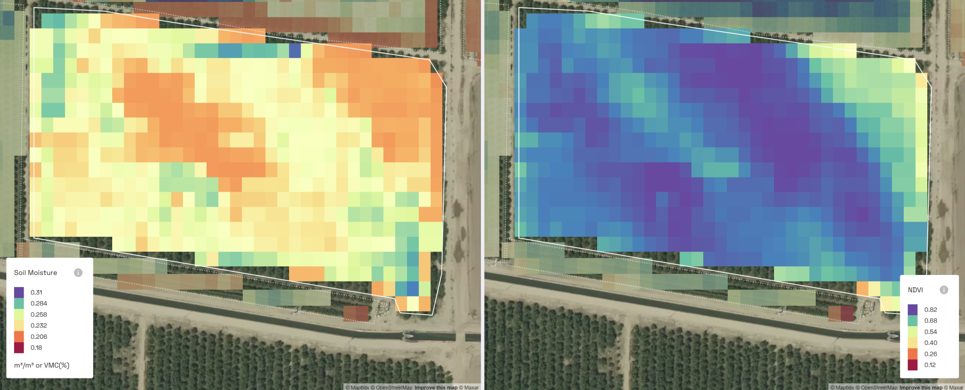
Remote sensing is the future as you’re not just talking about water requirement, it’s about the context of the crops surroundings in semi-real time (the microclimate around the crop, soil moisture, how much the crop is actually using) and therefore you can account for the dynamic conditions the crop is actually under and get the crop what it actually needs on that day and not what the crop generically needs, without accounting for the dynamics that the crop is under… what if there is a heatwave, or increased high windspeed – the crop will detect this and still try and protect itself/ react/ be more stressed even if there is enough moisture in the soil and this needs to be accounted for.
- Irrigation cannot be treated just from a soil perspective when there are so many other factors influencing the crop
- Some of these factors you cannot see just by looking at the crop or looking at NDVI, you need the thermal data
Help us
Improve
Share With
Your Network
Share the IrriWatch Academy with your colleagues and network.
Helpful links
-
Home
-
Cookie Policy
-
FAQs
-
T&Cs
-
Privacy Policy
-
Feedback Form