Satellites and Remote Sensing

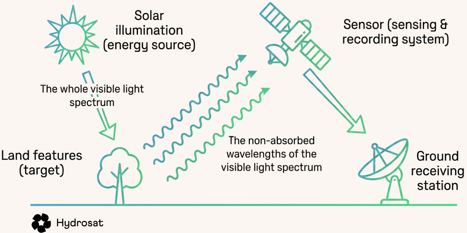
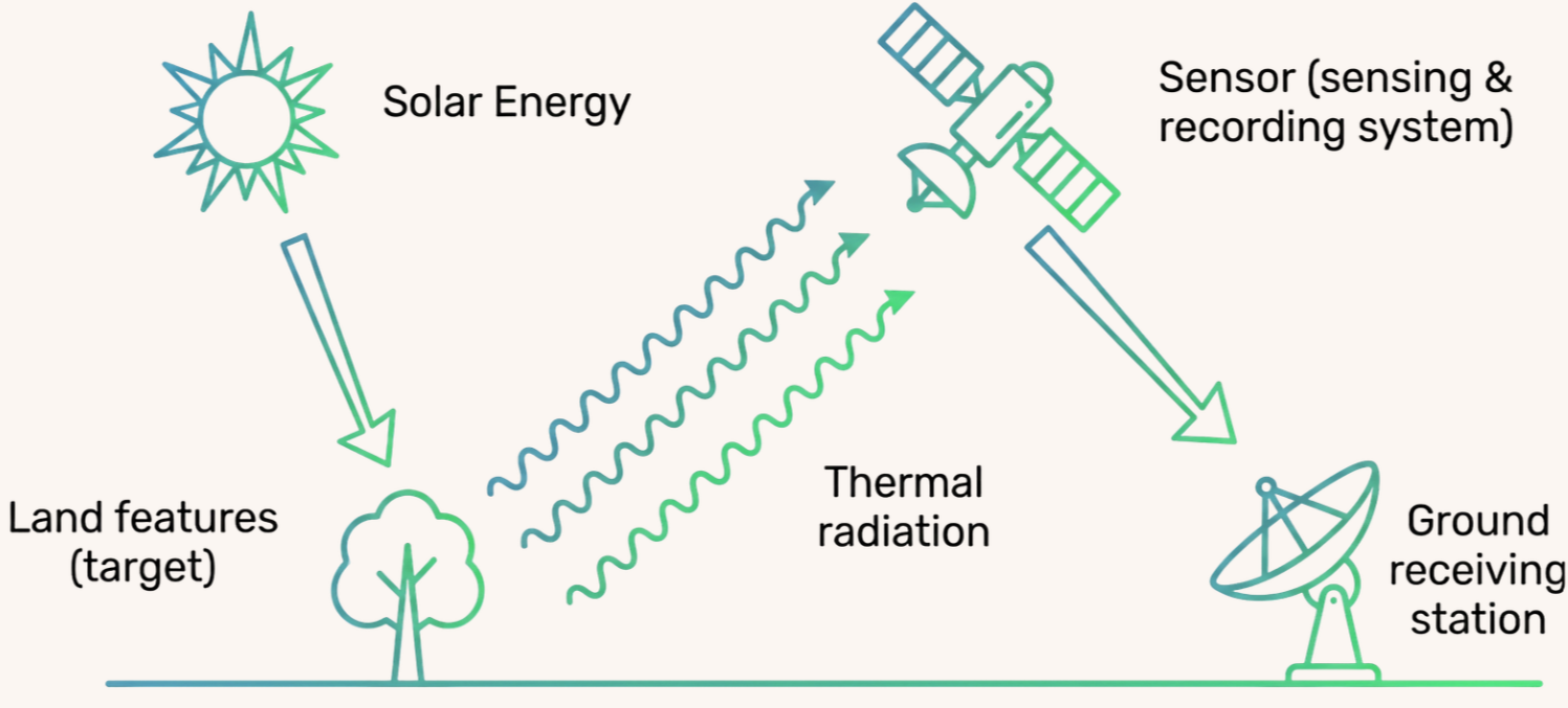
Remote sensing is a term that refers to the collection of information without ever making physical contact with that object. It predominantly relies on collecting and measuring light.

How do Satellites See?

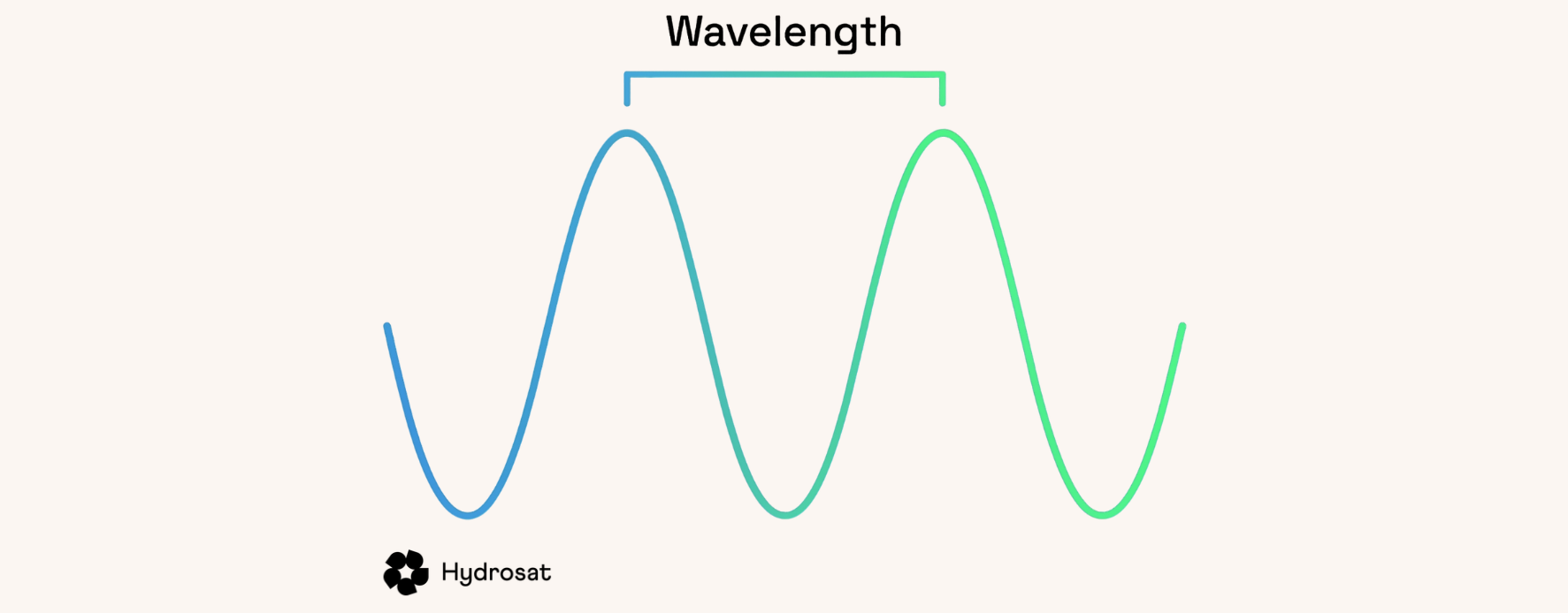
Light travels as a wave in a repeating pattern as well as exhibiting particle-like behaviour. Each type of light has a specific wavelength – the distance from one peak to the next – and a corresponding amount of energy that determines how it interacts with the world around us. 
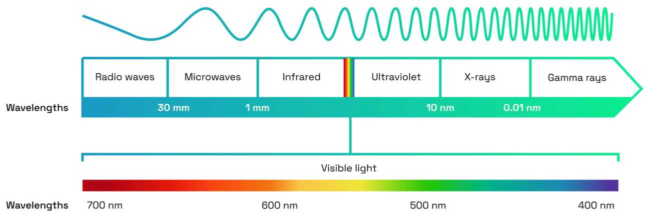
The full range of these wavelengths is known as the electromagnetic (EM) spectrum, which has been sectioned into different groups based on their shared properties. 

Some of these groups of light are already very familiar, even though we cannot see them. You may have heard of microwaves, which heat food in a microwave; radio waves, which are used to transmit information to our phones or radios; and ultraviolet light (UV), which can cause sunburn. These are three examples of light, but all with different wavelengths, energy levels and properties. 
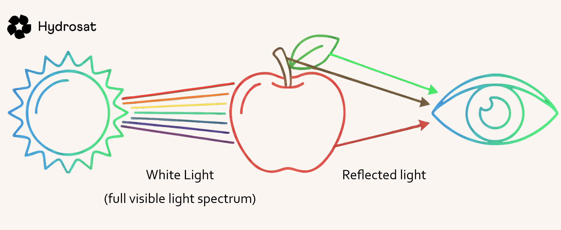
Visible light is the small part of the EM spectrum can be detected by human eyes. Sunlight contains all the wavelengths in this visible range, which makes up the colours of the rainbow. When sunlight shines on an object, some wavelengths are absorbed while others are reflected. 
The reflected light travels into our eyes, where it is detected by specialized cells and sent to the brain. The brain then processes this information, allowing us to recognize colours, shapes and textures.
In other words, we see the world because visible light reflects off objects and reaches our eyes, giving us the information needed to understand our surroundings.

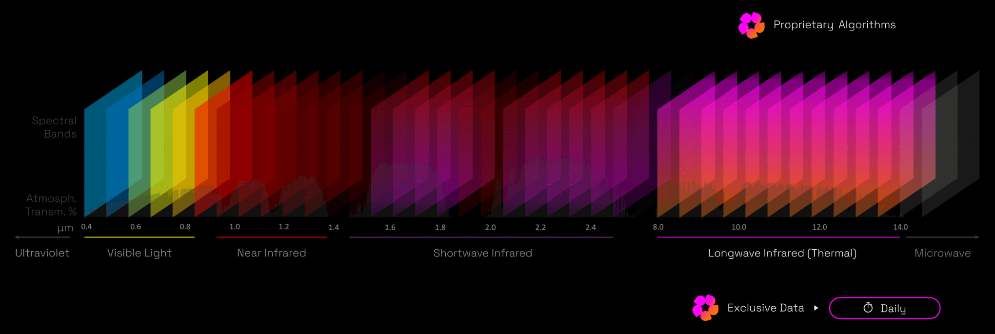
A similar principle is used by satellites, but instead of only being able to detect visible light, we can tailor each satellite sensor to measure a specific range of wavelengths (groupings known as bands). 

In Hydrosat’s case, we chose to measure mainly in the thermal infrared (TIR) section of the EM spectrum, specifically the longwave infrared (LWIR) band. Hydrosat also uses data from the visible light band and all the other bands in the infrared group too. 

TIR measuring works slightly differently to visible light detection as, instead of measuring reflected sunlight, it measures the radiated heat absorbed from the sun and reemitted from the surface.
Write your awesome label here.

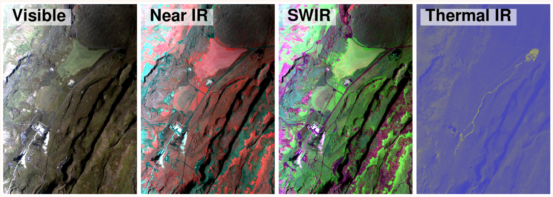
Like our eyes, the measurements taken by satellites at any wavelength can be turned into images. These images are like camera negatives so are then colourised by applying three colours: red, green and blue (RGB). For an image that looks like human eyesight, known as a true colour image, you would apply the red band of visible light to red, the green band of visible light to green and the blue band of visible light to blue. 

Write your awesome label here.

We can also make colour composite images where you assign different bands to RGB and this is done to learn more about the interaction between the bands of light on the subject matter. They highlight specific phenomena, depending on the bands chosen and which band you apply to which colour, and are therefore useful for different applications.

Want to learn more? Click below to read about another linked topic

Help us
Improve

Your feedback helps us make our Academy more useful. Tell us about your experience and what you'd like to see next.

Share With
Your Network

Know someone who could benefit?
Share the IrriWatch Academy with your colleagues and network.